North Coast Beckons

When I waxed eloquent on Sapphire Coast, I had no clue we'd embark on another 1700 Km drive to North Coast. But you can't possibly go overboard with beaches when your 'land is girt by seas'. Wavering golden patterns of waves and sun on the sand beneath, glittering horizon like fairy's gold dust, enticing warm and clear tang of sea are irresistible, unescapable. I can spend hours simply sitting by the shallows and watching the waves barrelling back to the vastness of blues before my eyes after briefly nudging me with their crests.

Without much ado, I'll quickly relive those four days once again through the pictures here, so when I revisit this page, the indelible vibrance will help me reset, revive, rejuvenate!
Our first-day-first-spot was about 3 hours drive (250 Km) from home. Shoals of transparent fish in ankle-deep water greeted us at the banks of Smith's Lake as we stretched our legs to break the drudgery of driving. The water, to my surprise, was salty.
Refreshed, we headed for Seven Miles Beach. As the name suggests, a long stretch of almost empty beach lay before us, but it was far from calm. Waves were high and wild; the day was a scorcher - typical dog days; a signboard at the entrance bore the caveat of "swim at your own risk, no lifeguard ". That proviso did little to stop us in the face of the sultry afternoon. Who'd dither to ditch the heat? We changed into swim shorts and tops and stepped into the water before we could change our mind - our only company was a family of 4 and their brown dog that gingerly lolloped after the retreating waves but steered clear of the incoming swells. Far away, the horizon along the beach was hazy with spray of mist and vapour.


Seven Miles Beach
Soaked and sated, we finally decided to start for Cape Hawk lookout. It wasn't an easy one - 375 steps each way winding and spiralling through a lush rainforest teeming with life - well, cicadas to be precise, for their buzzing thrummed in our ears like a thousand marcus at play. And mosquitoes - there was no way we could deprive them of some amazeball entrée out of our blood, bon appetite! The view goes by the name. It was easy to realise how hawks see our towns, coasts, creeks, rivers (Coolonglook and Wallinger here), lakes (Wallis Lake here), and islands (Mills Island here). After we caught our breath and captured some stunning hues, the reality of how tuckered out we'd gotten sank in. Sweating in sweltering evening we clambered back to our car and sighed with relief in its air conditioned interior. But that was ephemeral as we had to brace up for another long drive of over 2 hours (220 Km) to Numbucca, speeding past Forster, Taree, Port Mcquarie and leaving behind a network of waterways weaved by rivers like Manning, Hastings, Wilson, Macleay.


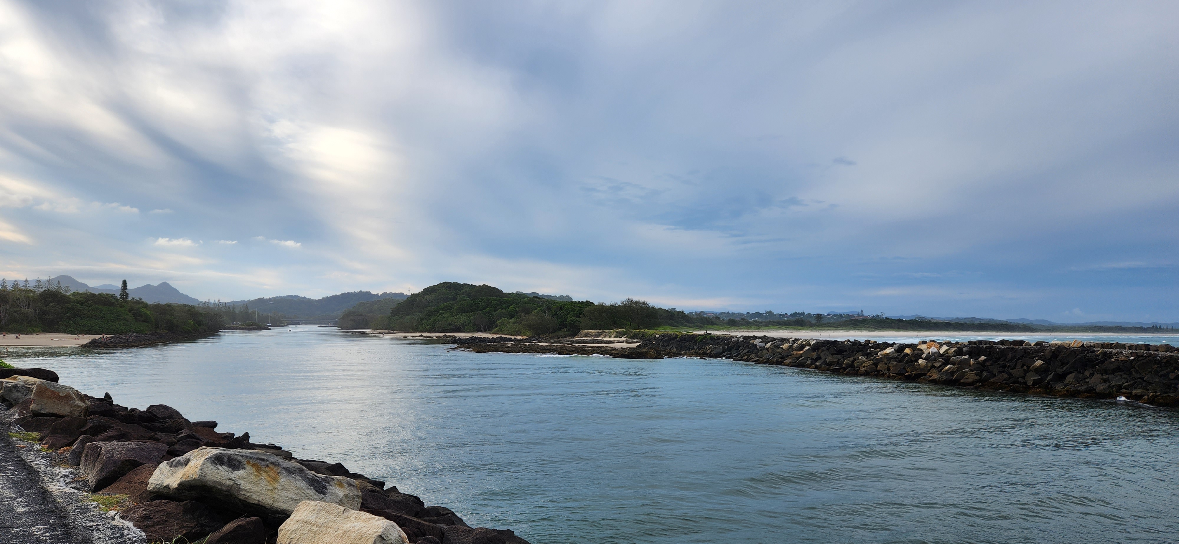
Rested overnight, we commenced our Day-2 with renewed zeal. Though the morning was cloudy, our spirits weren't. Everything we laid our eyes on looked beautiful. Our first stop-by was the V Wall. We walked along the interestingly painted boulders of the V Wall outlining and guarding the Numbucca River mouth. Forster Beach, shimmering at stone's throw was appealing yet unreachable without a water vehicle. We wistfully gazed at it as long as time permitted and headed for the Wellington Beach. The craggy verticals of the adjoining Wellington Rocks sketched intriguing backdrops of our captures.


Awe-inspiring rock textures


Jutting rocks make excellent backdrops


But, we couldn't be there forever; like the next unread page of a storybook, we headed for Urunga Broadwalk, about 20 Km northwards. Guess what - it turned out to be a serendipitous find. We quickly deserted the wooden walkway to wade in the shallows that stretched for several metres before embracing the endless ocean. The shallows were the confluence of rivers and lagoons that treated us not only with a curious (or rather a furious) octopus, saltmarshes, and mangroves, but also with a range of colours that varied with the depth of water. Urunga was far from quite. Camping ground was at stone's throw. Air was filled with cries of thrill and frolicking of children and adults alike. Pets are allowed. So with us we had a brown beauty that merrily waded at its neck-high water without the impunity (of the consequences like getting wet, changing, felling a sticky and sandy afterwards). As it capered, schools of tiny fish swam helter-skelter to escape what must have appeared to them as monstrous tsunami. On the banks, large yellow flowers adorned trees like a string of big yellow bulbs.💡 We walked up to them to have a closer view and decide if they were really natural! After a few clicks and picks (fallen flowers) we bid goodbye to Urunga.

We were at the red dots

The colours distinguish the depth

Ocean in the horizon - confluence of rivers and lagoon at feet


Spot the schools of fish on sand ripples
I thought octopus 🐙 was colourful!
56 Km north of Urunga, a sweeping view from Woolgoolga Headlands was awaiting us. We couldn't be wrong if we said we touched the end of land in as we ran down the slope to get as close as we could to the last rock. The abutting beach was wrapped with an abundance of sea shells 🐚 - such we never witnessed before - a shell-haven. Our little fistfuls were literally drops in the ocean - we filled our pockets with puerile satisfaction. Hauling ourselves up the slope was the only damper - but Denali Tramper walking poles and Denali water bladder saved the day.

Red dots for where we walked up/ down to and found the trove of shells


Another 2-hour (180 Km) drive later, we checked in to our accommodation, freshened up, and hit the road to explore Brunswick and Byron Bay. This wasn't the first time we were traversing the road on rocky bars that guard the river mouths embracing the ocean, but it was nevertheless mesmerising. A water dragon looking squarely at my lenses, and the screw pine trees with extraordinary roots knitting a knotted maze for bush turkeys brought zing to the walk.


Portal from a fantasy world? Nah, it's just Ballina to Brunswick


Byron Bay was the place to be at sunset. The frames here speak of the ineffable ethereal beauty.

Enthralling depths


Way to world's end?
Australia hosts innumerable spots of this genre but this one's not only eye-catching but also significant as it plummets to eastern most point of Australia - Cape Byron


Flavours of sunset - we stood below it, enraptured

Soon after we left the slopes of Byron Bay, darkness sandwiched us as we sped towards our accommodation at Ballina. We were convinced this place was conducive for aliens to land and explore!

Day-3 was bright and sunny. So, we went out and about the beautiful precincts in Ballina.
Australia boasts of a stellar collection of Big Things. Why miss the chance to grab a snap with The Big Prawn when at Ballina?


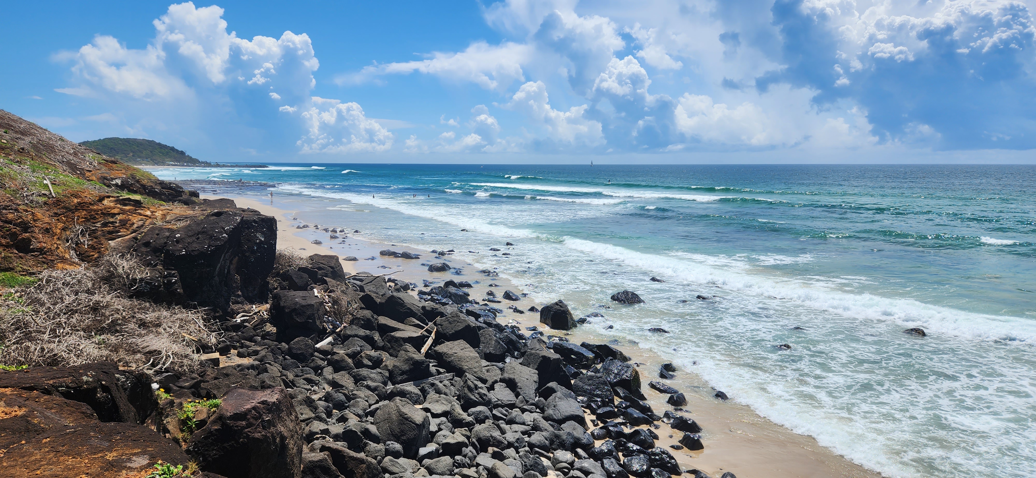
Richmond River mouth in Ballina, like all others seen before, is guarded by two parallel walls of boulders jutting in to the pounding waves of tumultuous ocean. Instead of walking to the furthest end, we took a detour to the Lighthouse Beach. Large black stones polished plain by the sea were scattered all over the beach. We picked a few to enhance our collection before driving to the exotic Ballina Head Lookout. See for yourself why it's "exotic" - the greens of screwpine blending into sea green waters look straight out of some travel glossies.


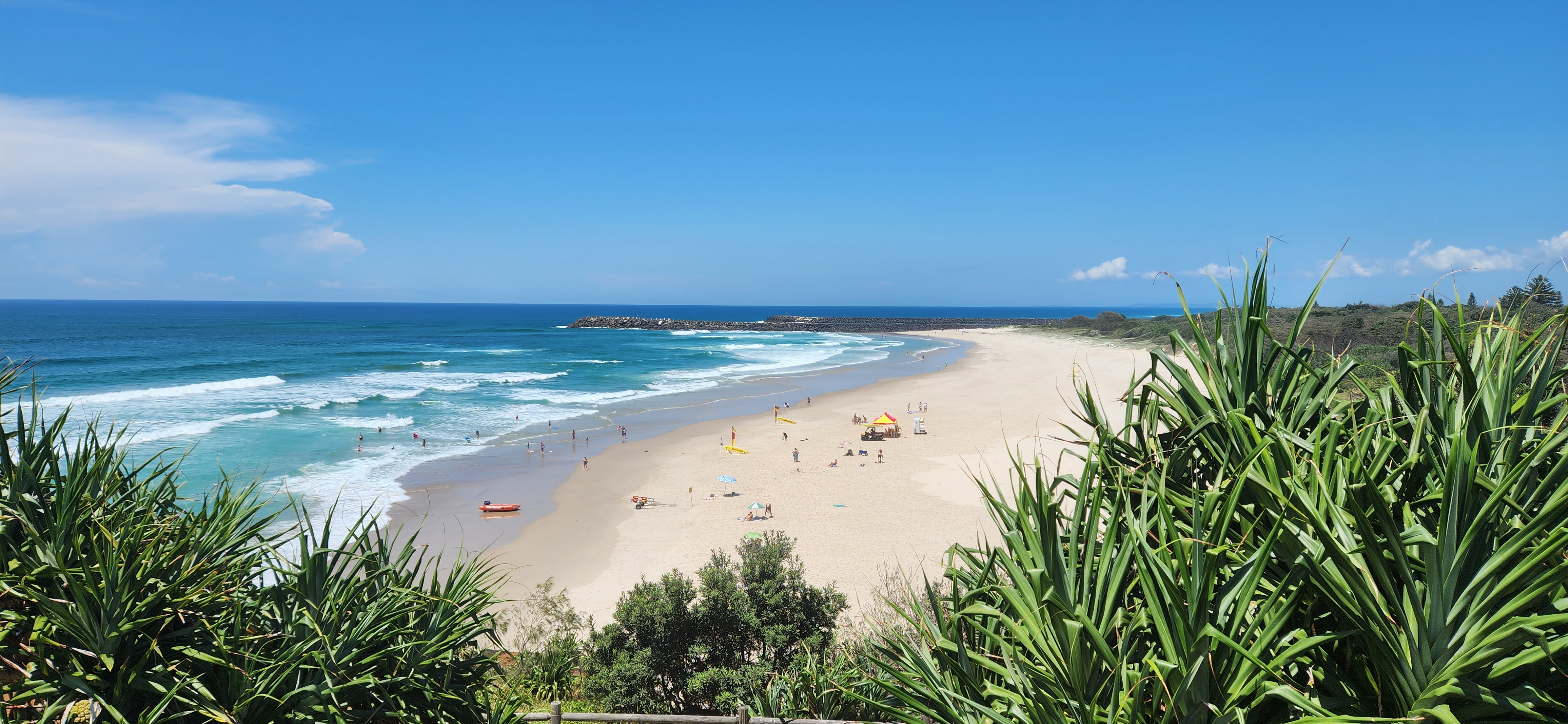


Coffs Harbour, a little over 2-hour drive (210 Km) from Ballina south bound, hosts The Big Banana - another Big Thing that we had in our bucket list for long. It crowns the gate to an amusement park. Since we had plenty to do outside the park, we only stopped by for some clicks with the Banana - afterall, I had to show off my lemon yellow jacket that I donned briefly only to match up the yellow background! Post lunch, we spent well over an hour at the Jetty Beach - a long stretch of flat sand bed makes it ideal for non-swimmers to savour the fun safely. We would've lingered there till dusk had we not booked our next accommodation further south at Port Mcquarie.


Another 1.5-hour (160 Km) drive later, we collected our keys from late-arrival safe box of our accommodation at Port Mcquarie, freshened up, dined, and went out and about the park by Hastings River. Lights and people enlivened the little city centre by the dark vastness of Hastings River. The river is widest here at its mouth, laboriously trudging to the sea. We walked past Little Shacks towards the guarded river mouth. Impaling the tenebrosity in the horizon, the silver temptress silently glimmered on the dark waters below; it was divine, it was a canvas on an invisible easel.
We kept our Day-4 concise as journey to home was a demanding 4-hour drive (375 Km). But the handpicked precincts were unimaginably awesome - Gaol Point (only 16.8 Km from London - HP, here I come), Town Beach (can't get bored of sparkling water rushing through rocks and crevices), Tacking Point Lighthouse, and Little Bay Beach - with just a few of us taking a dip there, it was nothing short of frames from a movie. I've no reservations to return here repeatedly!


On our way back, we took a break from fatigue of driving at Karuah - a quiet sleepy settlement by Karuah River. Picking up our favourite GYG nacho bowl for dinner from Heatherbrae, we drove home through bouts of intense rains, quite welcoming after the scorcher.


All this time our eyes gorged on the gorgeous greens, raving oranges, and bewitching blues - colourful memories created to cherish forever!
Dona, Sydney, January 2023
I'm always reading up articles on travelling. But this one here was a pleasure to read as we've been to 9 out 10 places mentioned in the post!


Comments
Post a Comment
Many thanks!!!